 |
| D.C. Metro Map |
I think this is a great instructional universal design for a variety of reasons. First, consider the colors used on the map. Each color signifies a certain line of transportation to certain areas. This is important as one may quickly identify which subway is needed, especially at multi-lined stops where several trains come and go at the same station. This may be the first line of cognitive processing for a first time commuter. Second, consider the dots located on each of the colored lines. Properly labeled, this is a great way to signify the appropriate stops for each train. Also, by making the dots white with a black outline, this makes the stops 'pop' more on the thick subway lines for easier readability. The larger dots with two black outlines also indicate a transfer stop. Making them bigger really makes it easy to see where a transfer would be and also that not every dot on the map that two train lines run adjacently are transfer stops. I also noticed how the map strips out almost everything but important landmarks and directional cues such as the Potomac River, a North directional arrow and the green areas for the national park areas. This helps the tourists especially who have no bearings to see much more accurately where they need to go. Finally, I think the map also is a great instructional resource as it is not to scale. Obviously, the stops will extend to great length into the surrounding areas but this is clearly not important for a commuter to have as what is important is getting on and off at the desired places and not worrying about scale in the map.
N.Y. subway map
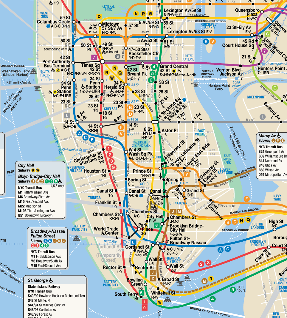
The New York subway map is obviously much more complicated and larger compared to the D.C. map. However, many of the same principles are used as described above but to a greater degree and complexity.
Have any of you used these maps? How about the NY subway? Did it work for you?
Great choice! I love the DC Metro map! I agree that it is so easy to use. I have taken many new folks to DC over the years, and I teach them how to use Metro so that they can get around on their own. Their map is clear, simple, and so easy to use - especially for tourists. In NYC I don't like their subway system, so I actually don't use it. I frequent NYC as well, but there either I drive, walk, or take a cab. Maybe if I became more comfortable with the NY system, I would actually use it.
ReplyDelete